Categories
Alberta Politics

The Good, the Bad and the Ugly: Alberta’s new electoral map will be a fight

Divided boundaries commission gives us a level-headed majority report and drastically different minority report

The final report of the bi-partisan Electoral Boundaries Commission usually settles where the lines are drawn on Alberta’s electoral map, but like most decisions in Alberta politics these days — an injection of polarization and partisanship threatens to tear apart a system that has worked pretty well for the past thirty years.

Alberta is getting a new electoral map for the next provincial election that increases the total number of ridings from 87 to 89 but what that map looks like will depend on what MLAs decide to do when the United Conservative Party government introduces the next version of the Electoral Divisions Act into the Legislature.

With duelling maps included in the final report, it’s unclear what the government’s bill will include and how active MLAs will be in redrawing the map themselves.

A fairly level-headed majority report was supported by government-appointed chair Dallas K. Miller (a retired Judge of the Court of Queen’s Bench of Alberta) and NDP-appointed commissioners Greg Clark (former Alberta Party MLA for Calgary-Elbow and former UCP-appointed chair of the Alberta Balancing Pool) and Susan Samson (former mayor of the Town of Sylvan Lake).

drastically different and much more controversial minority report was supported by UCP-appointed commissioners John Evans (a Lethbridge-based lawyer) and Julian Martin (a Professor Emeritus from the University of Alberta and former federal Conservative government senior staffer).

Read all about it on the Daveberta Substack

Categories
Alberta Politics

Alberta’s new federal ridings released.

The commission responsible for updating Canada’s federal riding boundaries have released their recommendations for redistribution in Alberta. The boundaries make some significant changes in rural areas and create fully-urban ridings in the cities of Calgary and Edmonton (following the 2003 redistribution, many of Edmonton’s ridings were expanded to include surrounding rural areas).

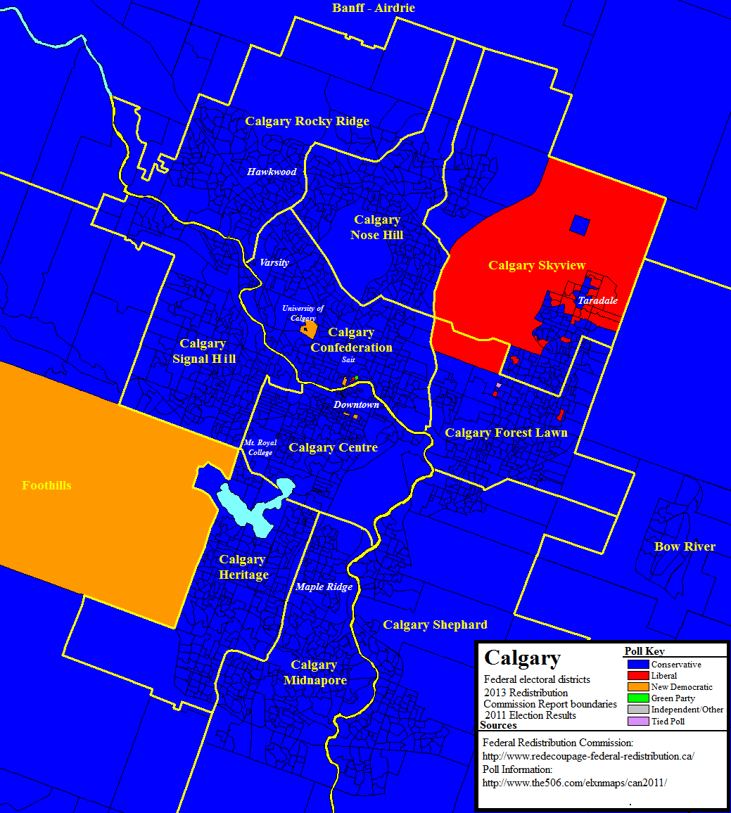
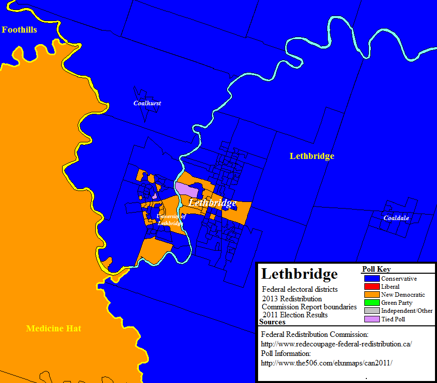
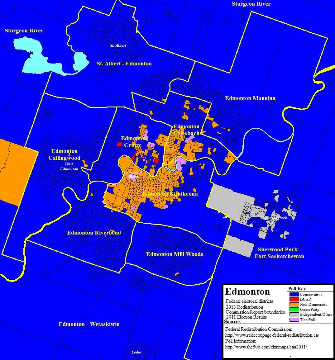
Below are the maps of the new boundaries transposed with the poll-by-poll results from the 2011 federal election. Looking back at the 2011 results, the new riding boundaries would have narrowed the Conservative Party’s margin of victory in a handful of ridings, including Lethbridge, Calgary-SkyviewEdmonton-Centre, and Edmonton-Greisbach (currently Edmonton-East), but would not have changed the electoral map in that election.

Also interesting to watch will be Calgary-Centre, where last year’s hotly-contested federal by-election drew national attention. Was the close race in Calgary-Centre the beginning of a new trend for that city or was it simply a mid-term anomaly?

New federal riding boundaries in Edmonton with poll-by-poll results from the 2011 election.
New federal riding boundaries in Calgary with poll-by-poll results from the 2011 election.
New federal riding boundaries in the Lethbridge area with poll-by-poll results from the 2011 election.

A big thank you to Kyle Hutton for creating these maps. Check out his blog, Blunt Objects.